

What Is an Orthomosaic Map—and Why Builders and Site Teams Use It
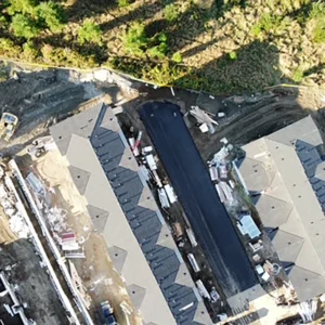
An orthomosaic is one of the most useful deliverables in aerial mapping because it’s simple: a high-resolution, measurable map created from drone imagery. For builders, site teams, and land development work across the Comox Valley and Vancouver Island, an orthomosaic can reduce confusion, improve coordination, and provide a clean baseline for planning.
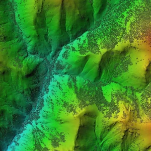
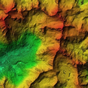
What is an orthomosaic (in plain English)?
An orthomosaic is a stitched aerial image corrected for distortion so it behaves like a map. That means it’s ideal for:
-
Viewing layout and context
-
Comparing progress over time
-
Marking up areas for planning and coordination
-
Creating clear visuals for reporting
Where orthomosaics help most
Builders and site development
-
Planning staging areas and access routes
-
Communicating site layout changes
-
Documenting progress for stakeholders
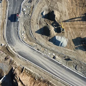
Infrastructure and maintenance
-
Visual documentation for road sections, shoulders, drainage, and right-of-ways
-
A clear “what’s there now” baseline for planning next steps
Environmental and stewardship
-
Visual baselines for reporting and monitoring
-
Clear imagery for communication and documentation packages
What you typically receive
Deliverables can vary by scope, but a practical orthomosaic handoff usually includes:
-
A high-resolution orthomosaic output
-
A structured folder system (easy to share internally)
-
Supporting visuals for quick review if required
Pair orthomosaic mapping with other outputs
Orthomosaics are often paired with:
-
LiDAR for bare earth models (DTM) and terrain-focused outputs
-
Volumetrics for measurable stockpiles and cut/fill reporting
-
3D modeling when a photoreal model helps planning or stakeholder communication
How to scope it properly (so you don’t waste money)
When requesting an orthomosaic, try to specify:
-
Your site boundaries (rough is fine to start)
-
How the map will be used (planning, reporting, documentation)
-
Desired turnaround time
-
Whether you need add-ons (volumes, DTM/DSM, 3D model)


